
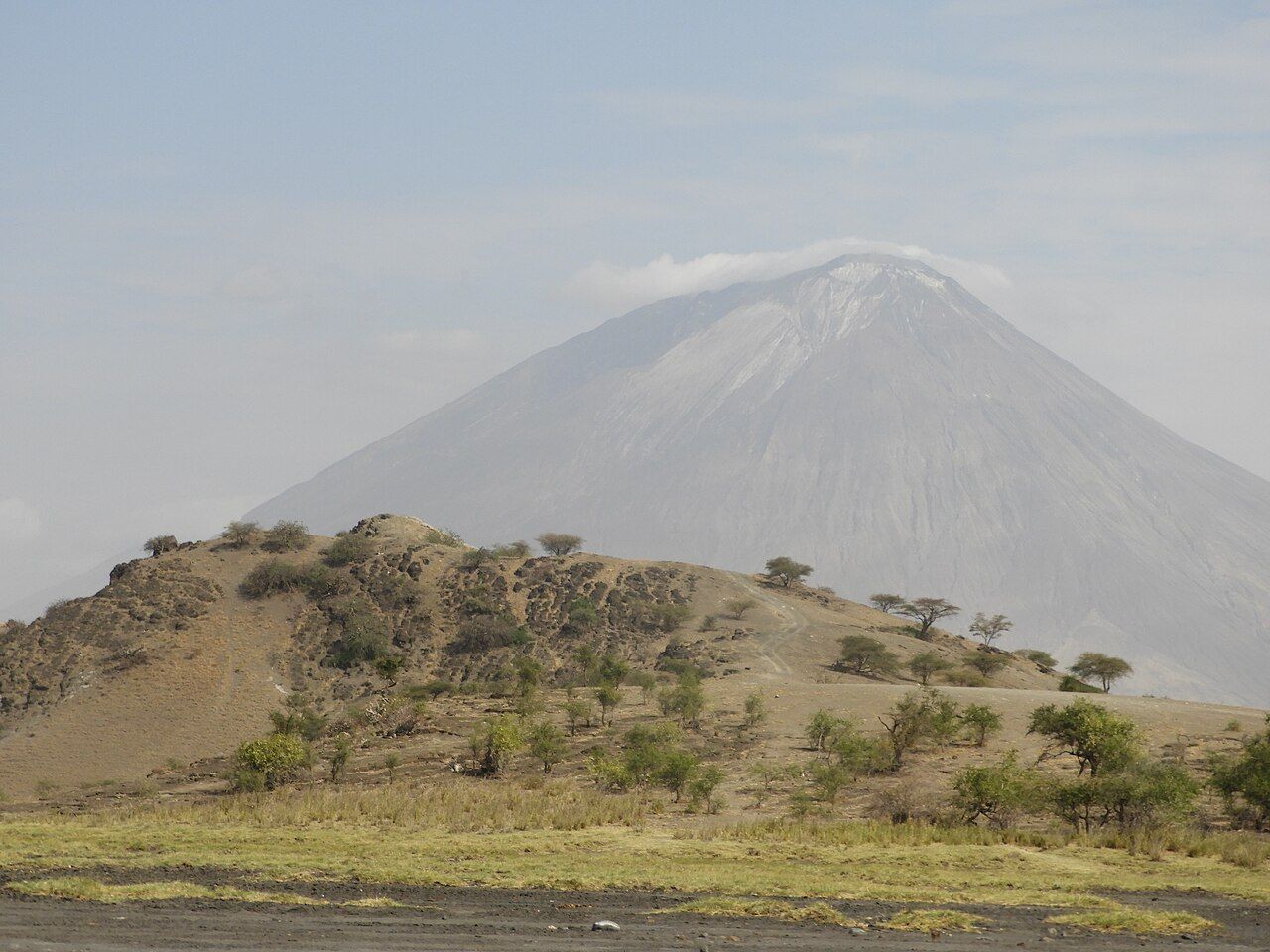
Lake Natron lies in the floor of the Great Rift Valley in northern Tanzania, close to the Kenyan border. It is shallow, salty and alkaline, fed by hot springs and rivers that carry minerals from the volcanic land around it. The shores are crusted with salt, and in the heat of the day the water shimmers in shades of pink, red and brown, coloured by tiny organisms that thrive where little else can.
Above it stands Ol Doinyo Lengai, an active volcano that the Maasai regard as sacred. The country around is hot, dry and starkly beautiful, and the roads in are long and rough. It is one of the most dramatic places in Tanzania, and one of the least comfortable.
A lake of soda and heat
Natron is one of several soda lakes along the Rift Valley, but it is among the most extreme. Temperatures often rise well above forty degrees in the middle of the day, and evaporation leaves a thick crust of soda on the mud. Few animals can live in the water itself, and the salt can preserve creatures that die in it, a fact that has made some photographs of the lake famous.
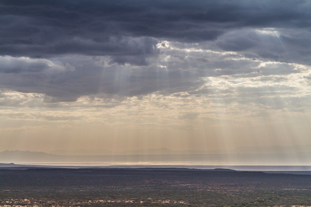
The heat sets the rhythm of every day. Mornings and late afternoons are for walking; the hours around midday are for shade, rest and water. Drink often, cover your head and neck, and take the heat seriously. Ask a doctor about any condition that heat might affect before you travel.
Flamingos
Lake Natron is the main breeding ground in East Africa for lesser flamingos. In some years, huge numbers gather here to nest on mudflats far out in the lake, where the caustic water and soft mud keep predators away. The breeding sites are remote and should never be approached; disturbance can cause birds to abandon their nests.
Visitors usually see flamingos feeding along the southern shore, especially near the river mouths, where fresher water mixes with the soda. Their numbers vary greatly from month to month and year to year, depending on rain and food. Walk slowly at the edge, keep low and well back, and let the flock settle. A pair of binoculars shows far more than walking closer ever will.
Other birds include pelicans, stilts, avocets and plovers. On the plains, you may see ostriches, gazelles, zebras and wildebeest moving between water and grazing.
The lake's future matters far beyond Tanzania. Plans for industry and water use around Natron have been debated over the years, and conservation groups have argued that the flamingo colonies depend on the lake staying as it is. Treading lightly, staying on established tracks and keeping your distance is a small part of that.
Ol Doinyo Lengai
Ol Doinyo Lengai rises in a near-perfect cone south of the lake. It is the only active volcano known to erupt natrocarbonatite lava, a rare kind that flows black and quickly turns white as it cools. Its slopes are streaked with pale ash, and its summit crater changes shape with each phase of activity.
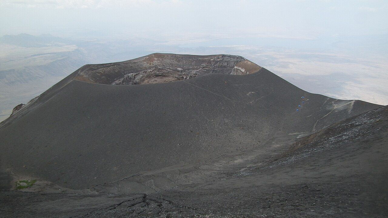
Climbing it is a serious undertaking. The ascent is very steep, on loose ash and rock, and is usually started around midnight to avoid the heat, reaching the rim at dawn. The descent is hard on the knees. The volcano's activity varies, and in some periods climbing is not allowed or is unsafe; climb only with an experienced local guide, and turn back if conditions are uncertain.
Further on: Lake Eyasi, between the escarpment and the onion fields
For the Maasai, Ol Doinyo Lengai is the home of God, and the mountain is part of their spiritual life. Treat it, and the people who live around it, with respect.
Maasai land
The land around Lake Natron is home to Maasai communities who herd cattle, goats and sheep across the plains. Villages such as Engaresero lie close to the lake. Visitor fees in the area are often collected by local communities as well as by the authorities; ask what they cover and how they are used.
Greet people, ask before taking any photograph, and accept a refusal gracefully.
You are a guest on someone else's land. Greet people, ask before taking any photograph, and accept a refusal gracefully. Do not treat homes or ceremonies as a show, and be wary of anything that feels staged for tourists. The page on visiting communities and wildlife responsibly has more on how to do this well.
Near Engaresero, ancient human footprints preserved in hardened volcanic mud have drawn scientific interest. Ask locally whether they can be visited and how.
Daily life here follows water and grazing. Herders walk long distances with their animals in the dry months, and the few springs and streams near the lake are vital for people and livestock alike. Keep vehicles off grazing land and away from water points, and never drive across fields or through a herd. Small things, like buying water and food in the village rather than bringing everything from town, help a little of what you spend stay here.
Walks, waterfalls and the road in
The most popular walk follows a river gorge into the escarpment west of the lake, wading through cool water between high rock walls to a waterfall. It is a welcome escape from the heat. Wear sandals or shoes that can get wet, and go with a local guide, as the river can rise quickly after rain upstream.
The road from Mto wa Mbu, near Lake Manyara, runs north through dry country and can take several hours. Much of it is rough, dusty and corrugated, and stretches may wash out in the rains. A high-clearance vehicle is essential. Some travellers continue north-west towards the Serengeti, a long and rough route.
Along the way the land opens out dramatically. The road crosses dry plains dotted with acacias and Maasai homesteads, then drops towards the lake with the escarpment of the Rift Valley rising in a long wall to the west. On the right day Kilimanjaro or Mount Meru may appear far off to the east. Fuel, repairs and supplies are scarce once you leave the main road, so fill up and carry spares before you set out.
Places to stay near the lake are simple, and most sit near Engaresero and the river. Nights are warm, and a breeze off the escarpment in the evening is a relief. Dust gets into everything, so pack cameras and electronics in sealed bags. Mosquitoes can be present near the river; cover up at dusk and talk to a doctor about malaria.
The dry season, from about June to October, is the easiest time to travel. Bring plenty of water, a sun hat, sunscreen and a headlamp. For a gentler taste of the Rift Valley's lakes and people, Lake Eyasi lies to the south-west, and the guide to dry seasons and rains helps you plan.
Pictures here: Pyjoel – CC BY-SA; Benh LIEU SONG from Torcy, France – CC BY-SA; Albert Backer – CC BY-SA


